|
|
|
Where was Atlantis?a report by Andrew Collins |
|
|
What is the true location of Atlantis? Is it Antarctica, the Aegean, America, the Mid-Atlantic or somewhere else?
The idea that Atlantis might be a memory of the fabulous palaces, courts and temples of Minoan Crete was proposed originally in an anonymous letter published by The Times newspaper in 1909 and found later to have been written by an Irish student named K. T. Frost. It was subsequently developed by a number of Mediterranean writers and historians and is today the most academically accepted theory on the origins of the Atlantis legend.
In the opinion of many, Plato constructed his Atlantis account from rumours and stories which circulated the Hellenic world concerning the former existence of the great sea-faring nation which had existed on the island of Crete and in other parts of the Aegean. It has been suggested that the Minoan culture was devastated in the aftermath which accompanied the eruption of Thera and the subsequent tsunamis that would have followed this cataclysmic event in c. 1628, 1450, or 1380 BC, depending on the source consulted. Archaeological evidence shows that ports and cities on Crete, as well as the Minoan town of Akrotiri on Thera itself, were destroyed in the manner alluded to by Plato in his works the Timaeus and Critias, written c. 350 BC. As further evidence of this theory, it is proposed that the Minoans' fixation with the cult of the bull reflects Plato's statements regarding the bulls that in the Critias are said to have wandered freely in the courts of Atlantis' Temple of Poseidon. Every fifth or sixth year, the princes of the Atlantean islands would come together to swear allegiance to the holy laws. At such times one of these bulls would be sacrificed and its blood allowed to spill on an inscribed pillar made of orichalc, 'mountain copper', perhaps a form of bronze. It is further considered that Plato's account of the naval war between the Atlantean aggressor and the Athenian nation preserves the memory of Crete's oppression of mainland Greece before the fall of the Minoan culture. All these are attractive ideas which might help explain certain aspects of Plato's Atlantis account. Yet Plato states clearly that Atlantis lay beyond the Pillars of Hercules - mythical rocks which stood at the entrance to the Atlantic Ocean. Moreover, Plato says that Atlantis was situated in front of an 'opposite continent' reached via a series of 'other' islands by 'voyagers' from his own world. He also places the destruction of Atlantis at a date post 8570 BC in the Timaeus and c. 9421 BC in his later work the Critias. Scholars, such as by Greek geologist A. A. Galanopoulos, get around this dating problem by suggesting that the dates and measurements given in the Timaeus and Critias are wrong. This is due to a mistranslation of the assumed Egyptian texts shown by an old priest in the temple of Sais in the Nile Delta to Solon, whom Plato asserts learnt of the story of Atlantis following a visit to Egypt in c. 570 BC. In the process, the famous Greek statesman somehow managed to confuse the hieroglyph that denotes the number 100 with the character representing a figurative value of 1000. If this were so, it would change the date implied for the foundation of Athens from 9000 years before Solon's visit to just 900 years, giving a revised date of c. 1470 BC, close to the traditional date of c. 1450 BC for the Thera eruption. Although this might seem like a neat and logical solution to both the problem posed by the very early time-frame suggested for the destruction of Atlantis and the unimaginable dimensions of Atlantis' city and plain outlined in the Critias, this argument is seriously flawed. Those Egyptologists who have taken time to examine the problem
assert that no such confusion can have occurred. The hieroglyphs used
to denote the numerical values of 100 and 1000 are visually quite different.
Solon - or anyone else for that matter - could not have made such a mistake.
This is made clear in an important essay on the links between Egypt and
Atlantis by J. Gwyn Griffiths, who points out:
Furthermore, we know from Plato's final work, The Laws, which appeared in c. 347 BC, that he really did intend to mean thousands, as opposed to hundreds, of years, for here he states that Egyptian art goes back 11,000 years. Since Solon does not feature in The Laws, we can say that this early time period was not determined from a misreading of Egyptian numerals. These early dates almost certainly derive from Egyptian king-lists, like the Royal Canon of Turin, which speak of divine and semi-divine beings who ruled for many thousands of years before the appearance of the first mortal pharaoh around 3100 BC. It was these mythical reigns that defined the greater antiquity of the Egyptian civilisation, and not those of the dynastic kings. We also now know that although the Thera eruption devastated the Aegean and caused tsunami waves which wrecked towns as far as the eastern Mediterranean, it did not destroy the Minoan civilisation of Crete. This continued on for several generations after the catastrophe and was superceded by the later Mycenean peoples from mainland Greece. For these reasons alone, Plato's Atlantic island could not have been Crete, Thera or any other location in the Aegean. Nor could it have been placed on the Turkish mainland in the time-frame of the Thera eruption as has been proposed by at least two authors (James and Zangger) in recent years.
Soon after the discovery of the American mainland by Christopher Columbus in 1498 Spanish historians began proposing that North America, South America or indeed the Americas as a whole was Plato's Atlantis. More recently, Bolivia in South America (Allen) and Central America (Zapp and Erikson) have been suggested for the site of the fabled Atlantean city. Certainly, the Americas do match the proportions of the Atlantic 'island' described in his works the Timaeus and Critias, written c. 350 BC. If Atlantis did once exist, and it really was of the immense size proposed, there is no better solution. In actuality, this solution has a significant drawback, for after relating the size of the Atlantic island, the old priest of Sais tells Solon that 'from it [i.e. Atlantis] the voyagers of those days could reach the other islands, and from these islands the whole of the opposite continent. 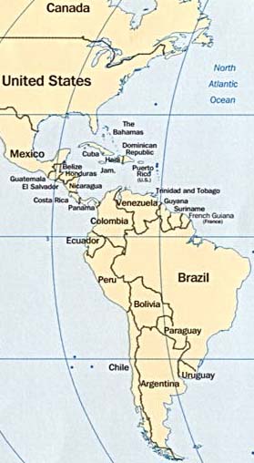
This last statement should be seen in the context of the age in which it was written. To put it bluntly, there was no 'opposite continent' in Plato's day! Yet Plato seems clearly to be referring to the American mainland, suggesting therefore that he was somehow aware of its existence on the other side of the Western Ocean, most probably through stories and rumours circulating the philosophical world (other classical writers such as Aristotle, Theopompus, Plutarch and Strabo also allude to an opposite continent). So if the 'opposite continent' he describes was America, this means that it cannot have been Atlantis as well. This paradox has led some writers to propose that if America was Atlantis then the Pacific Ocean was the true outer ocean and eastern Asia was the 'opposite continent'. Although there is good evidence to suggest both transatlantic and transpacific voyages to America in ancient times, there seems no reason whatsoever to draw such farfetched conclusions. America is quite clearly a continent and Atlantis was unquestionably a 'daughter of Atlas', a term used to denote an island placed in the Atlantic, or Western, Ocean. As the name suggests, the ocean came under the patronage of the Titan Atlas, who governed the lands and seas in the extreme west of the ancient world, including those that lay beyond the Pillars of Hercules - mythical rocks which stood at the entrance to the outer ocean. Furthermore, it can be shown that the idea of Atlantis being an island landmass the size of Libya (North Africa) and Asia put together is seriously flawed. In Plato's second Atlantis dialogue, the Critias,. Plato speaks clearly of a vast irrigated plain which 'stretched for three thousand furlongs [603 kilometres] in one direction, and at its centre, for two thousand [402 kilometres] inland from the coast'.(26) In the original Greek text the great plain's measurements are specified as 3000 by 2000 stadia (552 by 368 kilometres). Beyond the plain to the north was said to have been an extensive mountain range 'that came right down to the sea', creating a 'precipitous coastline' that 'sheltered the city from cold northerly winds'. The citadel itself was located on the southern edge of the plain, apparently on the site of a 'mountain which was nowhere of any great altitude', where Euenor, the mortal ancestor of the kings of Atlantis, had previously lived in a cave with his wife and daughter. Rivers and streams that began in the mountains were said to have flowed down into a fosse or trench that helped irrigate the fertile plain. These facts and figures convey the idea of a much smaller island than Plato would have us believe. Only the northerly placed mountains appear to divide Atlantis' rich fertile plain from its precipitous northern shoreline. No mention is made of the extent of this mountain range, although it cannot have covered an area of land equal to that proposed by Plato when he tells us that the island was the size of Libya and Asia combined. Even the mighty Himalayas of central Asia, although around 2400 kilometres in length, are only between 160 and 240 kilometres in width. Atlantis' northerly placed mountain range cannot have been any wider than the Himalayas, implying that at its greatest extent the island was no more than 600 kilometres from coast to coast. Indeed, if the mountain range really was only a few kilometres in thickness, it would suggest that Atlantis was no more than 400 or so kilometres in width. All these points make it highly unlikely that America is Atlantis, or that any mainland cities, prehistoric features or ancient ruins, in Bolivia, Costa Rica or anywhere else, are the remnants of the Atlantean city. We shall have to look elsewhere for the true location of Plato's island paradise.
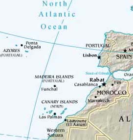
A very plausible solution to the Atlantis mystery is that Plato's Atlantic Island was located in the Mid-Atlantic and that the island chain known as the Azores are its surviving remnants. This cluster of nine main islands is located amid a chain of underwater mountains that rise to heights in excess of 9000 metres. They form part of the Mid-Atlantic Ridge which defines the division between tectonic plates, aligned approximately north-south beneath the ocean floor for some 17,600 kilometres. It is the tips of the very highest of these subterranean mountains that protrude from the ocean floor as the principal islands of the Azores, which are themselves endowed with sizeable mountains that soar to a height in excess of 2100 metres.
Despite this drawback, Donnelly's original thesis of a central Atlantean landmass has been perpetuated by a number of well-respected scholars of the Atlantis mystery. They include Russian academic Nikolai Zhirov. In the 1960s he wrote a series of papers on the subject, as well as a definitive book entitled Atlantis - Atlantology: Basic Problems, published in 1970. Like Donnelly, he argued that the former Atlantean landmass lay in the vicinity of the Azores and that, before it sank without trace, it acted as a land-bridge for the migration of flora and fauna between Africa and the Americas. Christian O'Brien, a retired industrial geologist, archaeologist and historical writer, has also tackled the concept of a mid-Atlantic continent having once existed in the vicinity of the Azores. In his 1997 book The Shining Ones - co-authored with his wife Barbara Joy - he proposed that the Azorean landmass, as he sees it, suffered immense cataclysms and eventually sank into the earth's liquid magma, leaving only the Azores as hard evidence of its former existence. The discovery of six fields of hot springs in the vicinity of the Azores is, he postulates, firm evidence of this hypothesis. During underwater explorations off the island of São Miguel, the largest island in the Azores group, in 1971 Christian O'Brien found clear evidence of an underwater river bed filled with water-worn boulders. By applying detailed contouring methods to hydrographic charts, the O'Briens discerned that rivers draining off the southern slopes of São Miguel once converged together in a huge valley, now situated some 64 kilometres out from the present coastline. Other islands in the Azores group have yielded similar hydrographic anomalies, and in one case the O'Briens even traced a series of river valleys which extended for a distance of 288 kilometres before converging together in a much larger river basin. With a knowledge of ancient river systems, the O'Briens were able to reconstruct a land profile which revealed an Azorean landmass 'about the size and shape of Spain', with high mountain ranges rising over 3655 metres above sea-level, as well as impressive rivers that run 'in curving valley systems'. Furthermore, they have pointed out that: The conclusion drawn from these findings is that the Azores once formed part of a much greater landmass which sank beneath the waves and is now situated 'many thousands of feet' below the current sea-level. To obtain a more substantial insight into this fascinating subject, the O'Briens propose that a scientific team take a series of core samples from the proposed sites of their river channels. They confidently predict that these will show not only evidence of ancient river beds, but also of the freshwater flora and fauna which once thrived on the former Azorean landmass. These are fascinating insights into the protohistory of the Azores group. Yet there are fundamental problems in accepting the theory of a former Azorean landmass. It is now known, for instance, that the volcanic mountains which constitute the Mid-Atlantic Ridge are of relatively recent composition. They are like age-old geological scars on a gaping wound that never properly heals. The north-south orientated tectonic plates produce an upward flow of magma which constantly creates new underwater mountain systems that are unlikely to have formed part of a geological landmass in the manner described. In addition to these problems, we must also acknowledge that there is now wide-scale acceptance of the so-called continental drift theory, first proposed in 1915 by the German meteorologist Arthur Wegener. In simple terms, this asserts that many millions of years ago the American and African landmasses were joined together, yet ever since they have been slowly moving apart. Just by making paper cutouts of the different continents and slotting them together we can see they fit snugly, suggesting that the continental drift theory is real. Furthermore, the fact that the American and African continents were once joined together explains much of the flora and fauna they share. More damning is the fact that when the first Portuguese navigators reached the Azorean islands in 1427, they found them devoid not only of human life but also of any fauna. Even though some evidence has emerged to imply that in the third century BC Carthaginian vessels from North Africa reached Corvo, the westernmost of the Azorean islands, no archaeology has come to light to suggest that the archipelago ever supported an indigenous culture. Even if the O'Briens' proposals regarding prehistoric river beds, located off the coast of São Miguel, do prove to be correct it seems unlikely that Plato's Atlantis is the memory of a high culture which once thrived on any proposed Azorean landmass. No evidence of an indigenous culture has ever come to light on any of the islands and there is no reason to assume that Plato's Atlantis account alludes to a landmass of this sort. Even though he did state that Atlantis was the size of Libya (North Africa) and Asia combined, it can be argued that this did not relate to the physical size of the island but to the extent of the dominion held by the kings of Atlantis. This can be determined from the Critias, where Plato refers specifically to a much smaller, east-west orientated landmass that cannot have been any more than 600 kilometres in width (see the entry for the Americas). I'm afraid we shall have to look elsewhere for the true location of lost Atlantis.
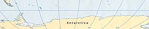
Look at any world map showing the migrational routes of early man and Antarctica is always avoided. Scholars will tell you that the ice-bound continent was never occupied due to its extreme weather conditions and inaccessibility. However, after many years of speculation about alleged structures and artefacts being found and hushed up on Antarctica (none of which are likely to be true, I might add) comes better news that ancient man did once inhabit the region. This information was given to me by Italian engineer and writer Flavio Barbiero following his lecture at San Marino (see news page) on Antarctica, Atlantis and a proposed pole shift following an impact event in around 9500 BC (although I would contest this date, suggesting that the event occurred 8500 +/- 500 years). He tells me that the earliest possible evidence dates back to 1903. In that year the Swedish explorer Carl Larsen landed on Seymour Island, which lies in the Weddell Sea beyond the continent's north-west coast. In an area of exposed land he is said to have come across various fossils, showing a prior warmer climate, as well as numerous small cylinders and balls of clay, which appeared to be of artificial construction.
Flavio and his colleagues have been trying to follow up this story, with one of them even travelling to Sweden to interview Larsen's descendents. Although the artefacts were destroyed when the family home was lost in a fire, copies of Larsen's report, which includes an account of the discovery of the strange objects, has been found. I have requested a copy of this report and will follow up this story in due course. In addition to the strange cylinders and clay balls found on Seymour Island, it seems that sediment cores extracted by a Chilean research vessel from the sea-bottom beneath the ice off South Shetland Island, north of Antarctica, produced more evidence of a human presence in prehistoric times. In two separate cores flint tools of unquestionable human manufacture were found. How they might have come to be there is open to speculation. Yet the fact that they were found in cores taken from different locations suggests that there must be further evidence of human life so close to Antarctica. Once again, I will bring you further news of this story as and when it becomes available. When I began writing GATEWAY TO ATLANTIS it was my impression that Antarctica was Atlantis. However, after studying Plato's story of Atlantis, preserved in the Timaeus and Critias I became convinced that this fabled island empire lay on the western Atlantic seaboard. I further pinned down the location to the Caribbean, Cuba in particular, with the sunken lands being the now drowned parts of the former Bahaman landmass and Cuba's Bay of Batabanó. This was the theory I went with in the book. However, even at this time I realised that the picture was slightly more complex. Although I could not prove it, my colleague David Southwell and I had worked out that prior to 15,000 BC Antarctica might well have been inhabited. Sometime around this date an event occurred to displace its indigenous peoples northwards towards South America, where they created new cultures. Others went by sea to the Caribbean, where they went on to found the Atlantean culture. As mad as these thoughts might seem, this is almost exactly what Flavio Barbiero proposed in his lecture at San Marino. He believes that the Antarcticans arrived via the prevailing ocean currents from Island Southeast Asia around 40,000 to 50,000 years ago. They settled in its north-west region, which at the time was still free of ice. Here they remained, he says, until 9500 BC when an impact event caused a sudden shift of the poles to their current position. Ice and rising waters from the melting of the old ice caps covered any evidence of their occupation. The Antarcticans, he proposes, migrated to different parts of the world including South America, the Caribbean, Africa, India, and even Egypt. We beg to differ on dates but I can handle virtually everything of what Flavio is proposing in this respect. Flavio Barbiero is seen in Italy as a respectable scholar. He is taken seriously! We have vowed to work together to sort out this mystery once and for all. As you might well know, the works of Charles Hapgood, the Flem-aths and Graham Hancock (see below) have all played with the idea that Antarctica might once have been the seat of a major lost civilisation. Yet it is as well to remember that the first scholar to propose that the earliest cultures of South America came from Antarctica was Arthur Posnansky, the archaeologist who worked so hard on Tiahuanaco. He concluded that its high culture came originally from the ice-bound continent as early as 15,000 BC and showed maps to this effect in his four-volume masterpiece on the ancient city. Ever since the great American horror writer Edgar Allen Poe wrote about a lost city in Antarctica in his 'The Narrative of Arthur Gordon Pym', which appeared in 1838, arguments have raged on whether or not this frozen continent once supported human life. Although Antarctica is the only major continent that has never produced any evidence of human occupation, it was Professor Charles Hapgood of Keene College, New Hampshire, who first drew attention to the fact that the continent appears on ancient portolans (port to port nautical charts) that long antedate the discovery of Antarctica by Capt. James Cooke in 1773-4. More important, some of these maps appear to show the landmass as it was before the ice obliterated its coastal features. In his opinion, these nautical charts were constructed from age-old source maps that had been copied and re-copied across many thousands of years and were the handiwork originally of a sophisticated sea-faring culture that existed as early as 7000 BC. Hapgood pointed out that although most estimates suggest that Antarctica became icebound as much as 300,000 years ago, core samples from the Ross Sea area show evidence of pollen spectra from a relatively green environment as late as 4000 BC. He also proposes that the ice only fully engulfed the landmass following a polar shift in c. 9500 BC, a date coinciding with the end of the last Ice Age. All these ideas are outlined in Hapgood's extraordinary book Maps of the Ancient Seakings, first published in 1966. Spurred by Hapgood's theories of a pre-ice Antarctica and a polar shift at the end of the glacial age, Canadian writers Rose and Rand Flem-ath proposed in their 1995 book 'When the Sky Fell' that the Antarctic continent was Plato's Atlantis. They pointed out that this huge landmass matches Plato's description of the island in both the Timaeus and Critias, which he asserts was the size of Libya (North Africa) and Asia put together. Furthermore, Antarctica lies beyond the Pillars of Hercules as also stated by Plato. |
|
Statement by Graham Hancock - 22 November 1999 Atlantis and Antarctica One of the many gross misrepresentations of my work to appear in the recent BBC2 'Horizon' documentary ('Atlantis Reborn', 4 November 1999) was the repetition of a most unfortunate error often made by other media as well, since the publication of Fingerprints of the Gods in 1995. This is the error that I was somehow the originator or creator of the theory that identifies Antarctica with the lost continent of Atlantis. I AM NOT THE ORIGINATOR OR CREATOR OF THIS THEORY. The full credit for it, as I explained in Chapters 50 and 51 of Fingerprints of the Gods, belongs to the Canadian authors Rand and Rose Flem-Ath who set it out in their book When The Sky Fell (1995) which I was privileged to read in manuscript form in 1993. I believed then, and believe still, that their theory is a ground-breaking one and that it is immensely important to any proper consideration of the possibility that there may have been a lost civilisation. My role vis-à-vis this original and well-thought-out theory was simply that of a reporter and synthesizer, just as I also reported and synthesized the work and theories of many other writers and researchers in Fingerprints of the Gods. Nevertheless despite the fact that I made this clear at the outset, and have continued to make it clear at every opportunity thereafter when the Atlantis/Antarctica theory has been brought up, there have been numerous occasions in both the print and broadcast media when this theory has been wrongfully credited to me. These repeated errors have, I know, been a source of great distress for the Flem-Aths, which I very much regret. In the case of the recent 'Horizon' programme, however, the error was further compounded, through the use of extremely selective editing, to make it appear as though I have now withdrawn all support from the Atlantis/Antarctica theory. This is not correct. As I explained at length to the 'Horizon' team in remarks that they chose not to broadcast, the sudden end of the last Ice Age is one of the great enigmas of earth history. I do not believe that this mystery can be explained by recourse to relatively slow and gentle climatic changes. I do very strongly believe that some cataclysmic agency must have been at work and I continue to believe that the mechanism advocated by the Flem-Aths, and by their predecessor and mentor Dr Charles Hapgood, namely a massive one-piece displacement of the earth's crust, is a very plausible explanation of the worldwide cataclysm that did indeed occur. Accordingly I defended the mechanism of earth-crust displacement forcefully against hostile questions from the 'Horizon' interviewer - who, amongst other things, accused me of being a 'pseudo-scientist' for so doing -- but none of this appeared in the final edited film that was broadcast by the BBC. In the same interview I went on to make further remarks concerning asteroidal and cometary collisions with the earth -- which, in my view are also strong contenders for the mysterious cataclysmic agency that ended the Ice Age. All this was cut out of the film as well. In conclusion on this line of questioning I reiterated that the end of the Ice Age was a cataclysm of almost unparalleled ferocity and magnitude and pointed out that the fact that this cataclysm did occur can be accepted from the overwhelming body of evidence that testifies to it - and, furthermore, is accepted by most scientists - even if there is not yet any agreement on the precise mechanism that caused it. The key fact of this mysterious cataclysm, I added, was a worldwide rise in sea levels of approximately 100 metres (more than 300 feet) which had changed the face of the earth completely -- inundating vast land-masses that might previously have been inhabited along almost all the continental shelves. All this, too, was edited out of the film and instead the producers homed in on a tiny snippet from my comments where I stated: "What I've come to realise, as my research has gone on, in a sense is that I don't need Antarctica and therefore I don't need to propose a radical revolution of geological ideas in order to explain a lost civilisation." Taken out of context as it was, this remark certainly does sound like a total withdrawal of my support from Atlantis-Antarctica and from earth-crust displacement. It was none of that, however, but merely the point in the interview, following a lengthy defence of cataclysmic theories, where I stated that my own research had now moved on in a different direction - based on the undisputed fact of global sea-level rise at the end of the Ice Age -- that involved scuba-diving on continental shelves all around the world and looking for the underwater ruins of a globally-distributed lost civilisation. Despite 'Horizon's' misrepresentation of my role in the formulation of the Atlantis/Antarctica theory, and of my views on earth-crust displacement and other cataclysmic theories, readers will find that my current position on these matters is concisely and coherently set out in Chapter 12 of my most recent book Heaven's Mirror (1998) - particularly on pages 207-212. On page 210, I point out that: "The earth-crust displacement theory advocated by Hapgood, the Flem-Aths and others has not been well received by orthodox planetary scientists. Geologists in particular have poured scorn on the theory, linked it to the lunatic fringe, and failed to give it any serious peer-review. The impression has been sucessfully conveyed that it is simply an 'impossible' process, advocated by lunatics and therefore not worthy of consideration by genuine scientists. Yet behind the scenes the evidence has been slowly mounting up that displacements of the earth's crust do occur from time to time and that there is no physical or geological reason why such a displacement should not have occurred around 12,000 years ago - precisely as the Flem-Aths allege."
Antarctica report by Andrew Collins (Contd.) Antarctica as Atlantis is an attractive proposition. However, this theory has major drawbacks. For example, Plato states that Atlantis was placed in the Atlantic Ocean which lay opposite the Pillars of Hercules, mythical rocks which stood either side of the entrance to the Mediterranean Sea. It also seems certain that the legendary island lay in the west since the name Atlantic is derived from Atlas, the Titan of Greek mythology, who was granted dominion over the lands of the Far West. This included the ancient kingdom of Mauritania (modern Morocco, Algeria and the Western Sahara) where we find Mount Atlas, which legend asserts is the petrified Titan supporting the heavens on his shoulders. Those who inhabited the region were known as the Atlantes (after Herodotus) or the Atlantioi (after Diodorus Siculus), while islands placed in the Atlantic Ocean were known as Atlantides, 'daughters of Atlas'. It was from this tradition that Plato chose the name Atlantis, 'daughter of Atlas', for the utopic world he describes in the Timaeus and Critias, written c. 350 BC. There is even a small island called 'Atlantis' said by the Roman writer Pliny to have laid off the West African coast, although this is clearly not the same one alluded to by Plato hundreds of years beforehand. Thus we can see that Plato's Atlantis was thought to lie in the direction of the setting sun, where the various Isles of the Blest, or Fortunate Isles, were also thought to lie, and not south in the direction of the South Pole. In addition to these facts it can be shown that the immense size attributed by Plato to his Atlantic island empire relates not to its geographical extent but to the regions of the ocean over which the kings of Atlantis were considered to hold dominion. This is verified in the knowledge that the Atlantic Empire consisted of a whole series of islands which lay in front of an 'opposite continent', an allusion most probably to the Americas, reached via a series of 'other' islands. Accommodating these facts into the Antarctica-Atlantis hypothesis would mean attempting to prove that the 'opposite continent' was either Australia or South America, with the 'other' islands being those of Indonesia, Melanesia or Micronesia. It just does not make sense (anyway, these are the remnants of James Churchward's lost continent of Mu, and not Atlantis!). The biggest argument against Antarctica being Atlantis is the sheer fact that no reliable evidence of human occupation has ever come to light, even though the continent really does appear on pre-discovery maps.
In 1794 Guatemalan doctor and scholar Paul Felix Cabrera proposed that Hispaniola was Atlantis as well as a mysterious Atlantic island called Septimania. Yet, as we shall see, his theories, although revolutionary, were flawed by political bias against neighbouring Cuba. GATEWAY TO ATLANTIS demonstrates that the core source material behind the Platonic Atlantean tradition originated in the Caribbean and was transmitted to the Mediterranean world by Iberic-Phoenician and Carthaginian seafarers. In complete secrecy these nations had been trading with the Americas, probably in concert with Berber peoples from northwest Africa, for hundreds of years prior to Plato's age. There is ample evidence to this effect in the accounts of Atlantic journeys recorded by classical writers, as well as from the discovery of artefacts and inscribes stones in the Americas and the presence of tobacco and cocaine in Egyptian mummies. The discovery of Roman wrecks off the coasts of Brazil and Honduras helps support the notion that after the fall of the Carthaginian Empire in 146 BC the Romans gained knowledge of these transatlantic sea passages and exploited them for their own purposes. To some readers these ideas might seem like astounding revelations. Yet it is clear that ever since the 'discovery' of the Americas by Christopher Columbus in 1492 certain open-minded scholars have attempted to demonstrate almost exactly the same thing. They have cited evidence from classical accounts to show that Phoenicians and Carthaginians reached the Americas and became the ruling elite of the Olmec, Maya and Toltec peoples. In addition to this it has long been argued that Plato's Atlantic island was one of the West Indies. It now seems certain that Plato's Atlantis was thought to have been located on the western Atlantic seaboard, plausibly in the vicinity of the Hesperides, the ancient name for the Caribbean. This seems affirmed in the Commentaries on the Timaeus of Plato by Proclus Daidochus, a philosopher, poet and scientist of the fifth century AD. Among the evidence he presents for the existence of Atlantis are fragments from a book entitled Ethiopic History by Marcellus, a Greek geographer who lived around 100 BC. He had asserted that 'in the external sea': ...there were seven islands...in their times, sacred to Proserpine, and also three others of an immense extent, one of which was sacred to Pluto, another to Ammon, and the middle of these to Neptune [the Roman name for Poseidon], the magnitude of which was a thousand stadia [184 kilometres]. They also add, that the inhabitants of it preserved the remembrance from their ancestors, of the Atlantic island which existed there, and was truly prodigiously great; which for many periods had dominion over all the islands in the Atlantic Sea, and was itself likewise sacred to Neptune. As long ago as 1962, historical writer Geoffrey Ashe associated Marcellus' seven islands sacred to Proserpine with the principal islands of the Lesser Antilles. He also went on to identify the three islands of 'immense extent' as Cuba, Hispaniola - which includes Haiti and the Dominican Republic - and Puerto Rico. The middle of the three, Hispaniola, was, he said, 'approximately a thousand stadia - i.e. a hundred miles [160 kilometres] or a little over - from side to side'.
As we have seen, in the Timaeus Plato tells us that the Atlantic island was situated within easy reach of 'other islands' that acted like stepping stones for ancient voyagers wishing to reach 'the opposite continent'. Such terminology could not describe the island chains of the Caribbean more accurately. The islands, banks, reefs and cays that stretch from Central America towards the Greater Antilles form a near continuous chain. Similarly, the Bahamas provide a stepping-stone route that links Florida with Cuba and Hispaniola. Moreover, myths and legends from all over the Caribbean and Bahamas talk of a former age when the archipelagos were one single landmass that split apart, leaving only the islands and cays we see today, following an almighty cataclysm involving a sudden inundation of the sort described by Plato in his Atlantis account. Other more detailed stories speak of this event occurring after either the 'ole moon broke' from its position or a fiery serpent fell from the sky. That Atlantis might have been located in the Caribbean is a revolutionary idea, although it is by no means new. Before the publication in 1882 of Atlantis - The Antediluvian World by ex-US congressman Ignatius Donnelly, which promoted the view that Atlantis was a now sunken landmass in the Mid-Atlantic, many historians had come to this same conclusion. In fact, the idea that Atlantis was Hispaniola would appear to have been first proposed as early as 1798 by Italian scholar Paul Cabrera, (it has been tackled again more recently by Emilio Spedicato, the Professor of Operations Research at Bergamo University). In Cabrera's opinion: I am confirmed in my selection of this island [i.e. Hispaniola] from among the many dispersed throughout the Atlantic, not only on account of its position and magnitude exceeding all the others, but also, from its fertility and numerous navigable rivers... Let us examine Cabrera's statements to see whether he is justified in making such assertions. Plato informs us that 'the district [of Atlantis] as a whole, so I have heard, was of great elevation and its coast precipitous', suitably describing Hispaniola's mountainous coastline. However, the island would have had no strategic importance to ancient seafarers. Neighbouring Cuba, on the other hand, has a large number of lobe-like bays along its coast, making it a better choice for the establishment of ports or places of refuge. Furthermore, Cuba's coastal waters guard both the northerly and southerly entrances into the Gulf of Mexico, making it an ideal staging post for maritime journeys to Mexico and the Gulf coast of North America. In addition to this, by using the Bahaman and Mid-Caribbean island chains a vessel can easily travel from Cuba to the coast of Florida and the Mosquito Coast of Nicaragua. It was for these reasons that soon after the time of the Conquest Cuba became known to Spanish explorers as the 'Key to the New World'. There is no way that Hispaniola can be awarded this same title, suggesting that Cabrera might have got it wrong. Cabrera also claimed that Hispaniola was in 'magnitude exceeding all the others'. This is blatantly untrue. At around 640 kilometres in length and 256 kilometres in width, Hispaniola is around two-thirds the size of neighbouring Cuba. In addition to these points, Cabrera further adds that Hispaniola was the most important of the islands because of its 'fertility'. Once again, this is completely false. Because the island is dominated by extensive mountain ranges that engulf much of the island, crop cultivation is difficult. It is Cuba that is the most fertile island of the Caribbean. Its fertile plains produce the tobacco for Havana's famous cigars. Moreover, they once produced more sugar cane than any other country. With the help of Cuba's rich red calcareous loam, its cane yields a higher content of sugar than anywhere else other than Mexico, a fact that led to it becoming known as the 'Pearl of the Antilles'. Lastly, it is not only Hispaniola that has extensive 'navigable rivers'. Cuba also has a series of mighty rivers that cut deep into the interior of the country and rise in the central mountain ranges. All this suggests that if Atlantis was located in the Caribbean, then it addition to Hispaniola, Cuba becomes an even more likely candidate for the same title (Emilio Spedicato's own points in favour of Hispaniola being Atlantis are discussed in GATEWAY TO ATLANTIS). So which of these great islands might have been the true location of lost Atlantis?
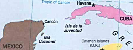
According to Plato, 'around the city [of Atlantis] was a plain, enclosing it and itself enclosed in turn by mountain ranges which came right down to the sea. The plain itself was smooth, level, and of a generally oblong shape; it stretched for three thousand stadia [552 kilometres] in one direction, and, at its centre [i.e. a line drawn north-south through the centre of the plain], for two thousand [368 kilometres] inland from the coast. All through the island this level district faced the south and was thus screened from the cold northerly winds.' This description of a great plain surrounded to the east, north and west by 'mountain ranges', matches almost exactly Cuba's western plain which stretches all the way from Havana westwards to Pinar del R�o and is enclosed on its northern and western extremes by the Cord de Guaniguanico mountain range. We also know that until around 9,000 years ago the plain extended southwards, across what is today the Bay of Batabanó, to the Isle of Youth. Here then is evidence of a vast plain, originally 540 by 160 kilometres in extent, drowned, at least in part, during the time-frame provided by Plato. Cuba's Cord de Guaniguanico might also be compared with the 'mountain ranges' that Plato tells us shielded Atlantis' great plain from 'cold northerly winds'. Between November and February each year, Cuba is subject to bitterly cold north winds, known as los nortes, or 'northers', that blow in blizzards from the eastern United States. Although these cold fronts reach exposed regions of the Cuban landmass, the Cord de Guaniguanico completely shields the western plain from these harsh winds, which would otherwise damage winter crops. There seems little question that if Atlantis is one of the main Caribbean islands then Cuba is the best candidate by far. Moreover, there are also other reasons for considering that Cuba is Atlantis. As we have seen, there is every likelihood that the core material for the Atlantis myth was carried back to the ancient world by Iberic Phoenician, and later Carthaginians, who visited the West Indies and Gulf coast in the first millennium BC. After the fall of Carthage in 147 BC the former Carthaginian territories were occupied by seafaring Berber tribes who accompanied the Moors when they invaded Spain in the eighth century AD. They would appear to have preserved the idea of a western isle lying far out in the ocean. They called it Antilia, a name that can be shown to derive from atl, the Semitic word root from which is also derived the name 'Atlantis'. Well-known geographers, such as William H. Babcock, have identified Antilia as Cuba, while the appearance of this legendary island on medieval maps matches very well a truncated form of Cuba found on the Turkish Piri Reis map of 1513. In 1966, Professor Charles Hapgood of Keene University determined that this nautical chart was derived originally from a patchwork of source maps that pre-dated Columbus' initial voyage to the New World. As a consequence, Hapgood concluded that Cuba must have been 'well known in Europe before the first voyage of Columbus'. Once again this would seem to confirm that Cuba was very much connected with the early source material behind the construction of Plato's Atlantean island. There is also evidence to this effect from the mythological traditions of the indigenous peoples that inhabited Central America at the time of the Conquest. The founders of various Mesoamerican royal dynasties were said to have arrived on the mainland from an island set in the waters located beyond the eastern horizon. Among these great civilisers was Quetzalcoatl, the god of the Toltec peoples of Central Mexico. There is every reason to suppose that this island homeland was one of the principal Caribbean islands, and some traditions record that it was Cuba. Its blood-red lateritic soil, which dominates the great western plain, accounts for the name given to Quetzalcoatl's original homeland - Huehue Tlapallan, the 'old, old red land'. Located on this island homeland was said to have been a place of emergence of the human race referred to in the accounts of the Aztec of Mexico and Quich�-Maya of Guatemala as the Seven Caves.
The only location in the Caribbean that has been found to match this description is Ceuva # 1 of the 'seven caves' complex at Punta del Este on Cuba's Isle of Youth (Isla de la Juventud - see map above). The walls of this prehistoric Sistine Chapel are adorned which dozens of beautiful petroglyphs of a celestial nature drawn by an unknown race several thousand years ago. The ancestors of the Mesoamerican peoples are said to have emerged from the Seven Caves and later founded seven clans and seven cities. There seems to be every reason to conclude that this tradition might well be the root behind the Portuguese medieval belief in the existence of the Island of the Seven Cities, another name for the island of Antilia, the medieval form of Atlantis. In the eighteenth century Friar Ramon de Ordoñez y Aguilar, canon of the cathedral town of Ciudad-R�al in Chiapas, told the odyssey of a Central American culture hero named Votan. He was said to have come out of the east from a land called Valum Chivim and, before journeying on to the Yucat�n, settled on an island named Valum Votan, identified by Ordoñez as Cuba. Evidence presented in GATEWAY TO ATLANTIS suggests that Votan was the memory of a Bronze Age Iberic Phoenician seafarer who made no less than four transatlantic voyages to Americas as early as 2000 BC. Here then is yet another example of how knowledge of Cuba's topography might well have entered the classical world prior to Plato's age. In conclusion, there seems good reason to assume that it was Cuba, and not Hispaniola, that was of the greatest importance not only to seafarers from the Mediterranean world, but also to the early ancestors of the Mesoamerican peoples. The political influences on locating Atlantis Following the discovery of the Bahamas in 1492, Columbus and his crewmen enquired among the indigenous peoples where they might obtain gold in great quantities. With a finger pointing southwards, they said 'Cuba', which thus became Columbus' next destination. On reaching the island's north-east coast the Admiral tried to imagine where he might be. Thinking that they had made landfall on the coast of either Cathay (China) or Cipango (Japan), he sent out an envoy with a letter of introduction to the Great Khan, signed by the sovereigns of Castille and Aragon. When this advance party failed to find any evidence of either the Great Khan or any cities of gold, Columbus lost interest in Cuba. The natives there directed him to another island known as Bohio. This turned out to be Espanola, modern Hispaniola, where he went on to establish La Navidad, the first city of the New World. This, however, was destroyed and replaced by the city of San Domingo which went on to become the administrative centre of the Spanish Caribbean. Despite further explorations by Columbus along its extensive coastline, Cuba was not colonised until 1511. It was the maniacal Spaniard Diego Velasquez who undertook this mission which ended with the decimation of almost the entire population of the island. Yet before his death in 1521, the conquistador had founded the so-called 'seven cities', or 'seven villas', echoing the Seven Cities which Portuguese legend asserted had existed on the island of Antilia. Despite fierce battles with the French, the English and Dutch buccaneers the Greater Antilles remained under Spanish rule for over 200 years. Then in 1697 France was granted sovereignty over the western half of Hispaniola, which subsequently became the republic of Haiti; the eastern half, known as San Domingo, remained under Spanish rule. France was granted the right of sovereignty over the entire island in 1785, although it took until 1801 for the last Spanish inhabitants to depart, due mainly to the concerted efforts of a former black slave and voodoo priest named Toussaint l'Ouverture. The French gave Haiti its independence, although this lasted only until 1806 when Spain reclaimed the eastern half of the island previously under French control. Then in 1821, during the Spanish-American revolution, San Domingo seized the opportunity to claim independence, establishing a republic under the wing of Colombia. Afterwards the island's two republics united themselves under one single name, Haiti, although this unity was broken in 1843. The following year San Domingo proclaimed itself the republic of Dominican. Despite Spain briefly reclaiming San Domingo between 1861 and 1865, the two countries have remained separate to this day. We can see from this brief history of Hispaniola that political motives might well have influenced peoples' decisions on where they might have wanted to locate Plato's Atlantis. For instance, during the sixteenth and seventeenth centuries the English believed that North America was Atlantis, due mainly to the fact that most of it belonged to them. On the other hand, the Portuguese believed, initially at least, that Antilia, the medieval form of Atlantis, was the Azores, perhaps because they claimed sovereignty over the island group. There was no way that an anti-Spanish nation could concede that Plato's lost island empire, which was thought to express the utopic ideals of a former golden age, lay in Spanish territories. Since Cabrera drew extensively from the work of French exegete and scholar Augustin Calmet, the chances are that his choice of Hispaniola as the location of Atlantis was influenced by France's sovereignty of the island.(16) Yet having set a precedent for associating Hispaniola with Atlantis, this same opinion would seem to have persisted throughout the nineteenth century. It might well explain why the Abb� Brasseur de Bourbourg believed that Hispaniola was the surviving portion of an Atlantean continent, which once extended out towards the African continent, and why in 1885 Hyde Clarke concluded that 'the head seat of the great king [of Atlantis] was possibly in the Caribbean Sea; it may be in St Domingo'. As a consequence of this persisting political climate Cuba would seem to have been overlooked as a possible candidate for the title of Atlantis, since it remained under Spanish sovereignty until the island's two wars of independence at the end of the nineteenth century. Cuba was finally granted independence in 1901 on the agreement that the USA would have a hand in running its affairs. This was the state of play when in the late 1950s Fidel Castro's communist movement gradually seized control of the country and ousted the pro-American Battista government. After the Cuban Missile Crisis of 1962, when President Kennedy demanded that the Russians withdraw nuclear warheads from Cuban soil, Castro's poverty-hit country has been shunned by western powers, its only ally being the Soviet Union. Trade embargoes, diplomatic isolation and a concerted propaganda campaign has kept Cuba out in the cold until recent years. Who would want to find Plato's utopic realm in a dull, grey communist country? Even Antarctica seemed a better option than Cuba. Now that the political climate is gradually changing for Cuba, we can see why the island becomes a primary candidate for the title of Atlantis. Underwater ruins have been noted occasionally in its coastal waters - one report even coming from Leicester Hemingway, the brother of the great American writer Ernest Hemingway. Furthermore, out-of-place artefacts and early sites of uncertain origin have been located here, while in 1857 the Abbe Brasseur de Bourbourg asserted that: 'Modern travellers assure that they have seen sculpted rocks and ruined buildings around Havana indicating the presence of ancient civilised populations on this Island'. I have argued that Cuba was most probably the ancient homeland of the ruling elite and earliest ancestors of the various Mesoamerican tribal cultures. It can also be identified as Antilia, the Island of the Seven Cities, one of the Hesperides and, most important of all, the flagship of the Atlantean island empire. This is not to say that Hispaniola did not have a role to play in the construction of the Atlantis legend, since it would seem to have been one of the islands which formed part of Plato's Atlantean 'empire'. It is even possible that some aspect of its topography found its way into the writings of Plato. However, the Atlantic island with a fertile southerly plain protected from cold northerly winds by mountains as described by Plato in the Critias is, in my opinion, Cuba. Moreover, the seven-fold division of the Atlantean city focused around a cave of emergence set within a mountain which was 'nowhere of any great height' is, I believe, a variation of the Seven Caves tradition. This mythical location I have identified as Cueva #1, the prehistoric 'Sistine Chapel' at Punta del Este on Cuba's Isle of Youth. Before the sea-level rose at the end of the last Ice Age, Cuba's great western plain extended all the way to the Isle of Youth. Yet just as Plato describes, it was drowned beneath the waves following 'earthquakes and floods' of the sort proposed in connection with the Carolina Bays cometary impact of the ninth millennium BC (see GATEWAY TO ATLANTIS). Cabrera's work is important in that it provides us with further evidence of transatlantic voyages in ancient times and confirmation of the true location of Atlantis. Moreover, it shows us that the theories outlined in GATEWAY TO ATLANTIS are nothing new. They have been around for at least 200 years, and possibly much longer still. The answers, it seems, remain the same; it is just the nature of the evidence that changes with time. All of these ideas are argued fully in Andrew Collins' book: GATEWAY TO ATLANTIS |
 Did
Atlantis ever exist? Was all or just part of its island kingdom drowned
in the cataclysm that supposedly devastated the Atlantic world in some
distant age of mankind?
Did
Atlantis ever exist? Was all or just part of its island kingdom drowned
in the cataclysm that supposedly devastated the Atlantic world in some
distant age of mankind? 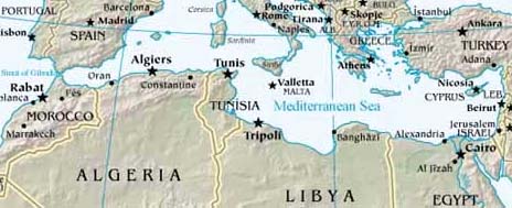
 Perhaps
the most important writer to propose that the Azores were remnants of
an Atlantean island continent was Ignatius Donnelly, author of the seminal
classic Atlantis: The Antediluvian World, first published in 1882. This
American congressman set down the foundations for the thousands of books
and articles that have been written on the subject of Atlantis over the
past 120 years. Although Donnelly's book has seen countless reprints,
much of what he had to say about Atlantis being an antediluvial motherland
for the diffusion of civilisation on both sides of the Atlantic has since
been proved incorrect.
Perhaps
the most important writer to propose that the Azores were remnants of
an Atlantean island continent was Ignatius Donnelly, author of the seminal
classic Atlantis: The Antediluvian World, first published in 1882. This
American congressman set down the foundations for the thousands of books
and articles that have been written on the subject of Atlantis over the
past 120 years. Although Donnelly's book has seen countless reprints,
much of what he had to say about Atlantis being an antediluvial motherland
for the diffusion of civilisation on both sides of the Atlantic has since
been proved incorrect.